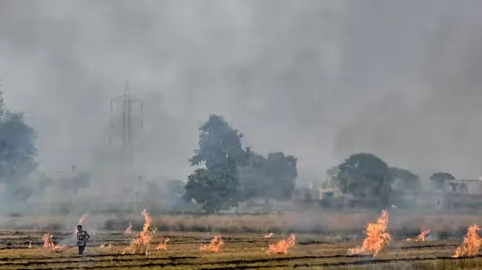
Farmers in Punjab and Haryana are reportedly finding ways to escape satellite detection while burning crop residue in their fields. The issue has surprised officials, especially as satellite data has shown a sharp decline in stubble-burning incidents in recent years. The situation has drawn comparisons with the techniques used during India's 1998 Pokhran nuclear tests, when scientists led by former President Dr APJ Abdul Kalam managed to keep key preparations hidden from foreign spy satellites. Now, farmers are learning when satellites observe their fields and are allegedly using that knowledge to avoid detection.
Understanding Satellite Surveillance
Farmers have reportedly realised that many satellites observe a particular location only when they pass over it. If stubble is burned outside these observation windows, the fire may not be detected by conventional monitoring systems. This has raised concerns among officials in districts such as Karnal and Kaithal in Haryana. The problem is not necessarily that fires have disappeared, but that existing monitoring methods may fail to capture every incident. Experts say the timing and location of fires are equally important for understanding the actual scale of the problem.
Why Fire Watch Was Developed
To address these gaps, the International Forum for Environment, Sustainability and Technology (iFOREST) has developed a multi-satellite monitoring platform called Fire Watch. iFOREST CEO Dr Chandra Bhushan said existing monitoring largely depends on fire alerts from polar-orbiting satellites. These systems do not always provide a complete picture of stubble burning. He explained that authorities need to know not only how many fires have been detected but also where and when they occurred. Fire Watch brings different sources of satellite data together to provide more detailed information to policymakers and the public.
Sharp Decline in Official Data
According to official figures cited in the report, stubble-burning incidents fell from around 80,000 in 2021 to nearly 6,000 in 2025. This decline was attributed to stricter enforcement, penalties, subsidies for agricultural machinery and awareness campaigns. However, experts believe the figures may not reflect every fire on the ground. Farmers' growing awareness of satellite observation schedules has raised questions about whether some incidents are escaping detection.
Limitations of Existing Satellites
Current monitoring mainly relies on four polar-orbiting Earth observation satellites. These include NASA's Terra and Aqua satellites, which carry MODIS sensors, and Suomi NPP and NOAA-20, which use VIIRS sensors. These systems generate most of the fire alerts used in northern India. However, they observe a particular location only at specific times, mainly around daylight and afternoon hours. Fires occurring outside these observation periods may go unnoticed.
How Fire Watch Tracks Fires
Fire Watch combines MODIS and VIIRS data with observations from Meteosat-8 and Meteosat-9, which carry SEVIRI instruments. Unlike polar-orbiting satellites, these geostationary satellites repeatedly observe the same region and capture images approximately every 15 minutes. This helps identify not only the location of a fire but also when the activity reaches its peak. The platform also uses Sentinel-2 images to compare farmland conditions before and after the burning season. This allows analysts to estimate how much agricultural land was actually burned, offering a more complete picture of stubble burning.